Jim and jimb,
For Spanish Mexican mining and treasure symbols, a book with commonly used symbols is Charles A. Kenworthy: Treasure Signs, Symbols, Shadow & Sun Signs.
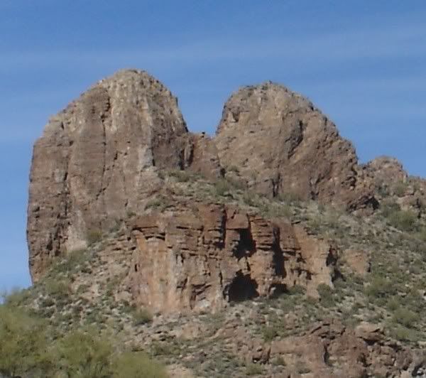
As for the Peralta Sombrero Sketch map, the Sombrero Butte is on the NE side of Malapais
Mountain. There is a trail that enters Peters Canyon on the NW end of Peters Mesa. At this point, facing North, is where this sketch was drawn. Peters Canyon zig zags North for about 1.25 miles. At the 1 mile point, below the Sombrero, is an arroyo on the East side of Peters Canyon. Here is the mine and most all of the clues. The Peralta Stone map leads here as well.
The only fiction I am aware of is Adolph Ruth writing that the Needle is in the center of the 5 mile circle.
twoguns
Sombrero Mt.
Moderator: somehiker
-
cubfan64

- Posts: 636
- Joined: Mon Aug 17, 2009 7:00 am
- anti-spam detector: No
- The middle number please (4): 4
Re: Sombrero Mt.
Adolph Ruth was not the original author of those words. It was actually written back around 1895 by P. C. Bicknell for a newspaper story. Bicknell apparently interviewed Julia Thomas sometime between Waltz dying and the article appearing in print.The only fiction I am aware of is Adolph Ruth writing that the Needle is in the center of the 5 mile circle
If it IS fiction, it would be fiction based on Bicknell that Ruth simply copied and carried with him.
-
twoguns
- Posts: 16
- Joined: Sat Dec 26, 2009 12:24 am
- anti-spam detector: No
- The middle number please (4): 4
Re: Sombrero Mt.
Jim,
Correct. Who knows what the actual words were after being retold over time. Waltz could have said "My mine lies within a 5 mile circle of Weavers Needle".
Who knows?
twoguns
Correct. Who knows what the actual words were after being retold over time. Waltz could have said "My mine lies within a 5 mile circle of Weavers Needle".
Who knows?
twoguns
-
twoguns
- Posts: 16
- Joined: Sat Dec 26, 2009 12:24 am
- anti-spam detector: No
- The middle number please (4): 4
Re: Sombrero Mt.
Jim,
This is the location of another Sombrero Mine clue.
Adolph Ruth had a Spanish/Mexican clue that described the junction of two canyons, one running South to North, flanked by high cliffs on either side, the other was brushy and came in from the East. Above this canyon junction Ruth expected to find a Spanish marker or symbol that would show him the trail to the mine.
The two canyons are Tortilla Wash and Peters Canyon. The mule trail comes into Peters(Tom Kollenborns sketch map), but does not follow 'the trick to the trail' in his map. It goes over this hill(East) into Tortilla Wash and heads South, on the West side of the wash. At the top of this hill is a Trail Marker, Cut Cactus, 3 symbols(X, seperated arrow, circle with dot in center and line pointing south) and a few items I have not located in any stories. The trail has markers all the way to the mine.
From Tortilla Flat it takes about 1 hr. to get to this hill. If you continue up Peters Canyon you can get to the site in another 2 to 3 hrs. taking a break or two. You can go to the mine and out in a day. It is tuff on the knees, so take it easy jumping across the boulders.
-
cubfan64
- Posts: 636
- Joined: Mon Aug 17, 2009 7:00 am
- anti-spam detector: No
- The middle number please (4): 4
Re: Sombrero Mt.
So if I understand you correctly, you've been to the mine?twoguns wrote:Jim,
This is the location of another Sombrero Mine clue.
Adolph Ruth had a Spanish/Mexican clue that described the junction of two canyons, one running South to North, flanked by high cliffs on either side, the other was brushy and came in from the East. Above this canyon junction Ruth expected to find a Spanish marker or symbol that would show him the trail to the mine.
The two canyons are Tortilla Wash and Peters Canyon. The mule trail comes into Peters(Tom Kollenborns sketch map), but does not follow 'the trick to the trail' in his map. It goes over this hill(East) into Tortilla Wash and heads South, on the West side of the wash. At the top of this hill is a Trail Marker, Cut Cactus, 3 symbols(X, seperated arrow, circle with dot in center and line pointing south) and a few items I have not located in any stories. The trail has markers all the way to the mine.
From Tortilla Flat it takes about 1 hr. to get to this hill. If you continue up Peters Canyon you can get to the site in another 2 to 3 hrs. taking a break or two. You can go to the mine and out in a day. It is tuff on the knees, so take it easy jumping across the boulders.
-
twoguns
- Posts: 16
- Joined: Sat Dec 26, 2009 12:24 am
- anti-spam detector: No
- The middle number please (4): 4
Re: Sombrero Mt.
I have been to what I claim is The Sombrero Mine, my opinion only.
-
twoguns
- Posts: 16
- Joined: Sat Dec 26, 2009 12:24 am
- anti-spam detector: No
- The middle number please (4): 4
Re: Sombrero Mt.
For those viewing these pictures.
I was not aware that changing my photos in 'Photobucket' would eliminate them from this forum. I truly apologize for this and have reposted then and will leave them in the bucket.
I did not remove any of the verbages and ask cubfan64 to repost his last if possible.
I will repost any of my information that was lost, please let me know.
Sincerely,
twoguns
-
twoguns
- Posts: 16
- Joined: Sat Dec 26, 2009 12:24 am
- anti-spam detector: No
- The middle number please (4): 4
Re: Sombrero Mt.
Picture 1 is a heart symbol that can be seen from the East. It is located just East
of Tortilla wash and Peters Canyon junction. From this rock you can see several
sets of symbols showing the way to the Sombrero Mine.
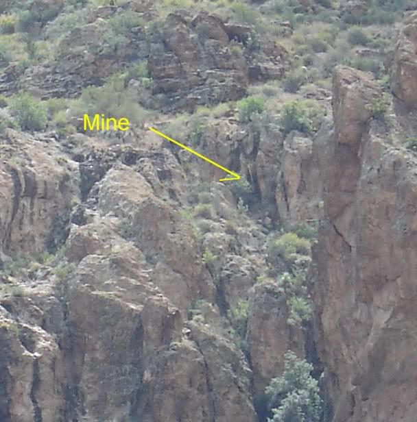
Pic. 2 is the mine entrance. Notice the square shape 30 ft' in front of the mine and
a little to the right.
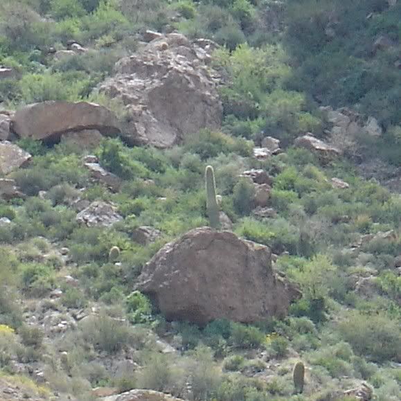
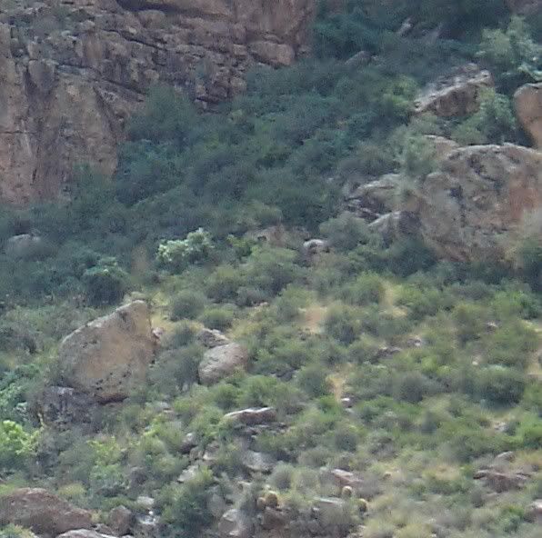
Pic. 3 & 4 are rocks below the mine. I believe these to be the 'cresent, triangle, and circle'
symbols.
Pic. 5 is a cave above the mine. There is a cross cut into the rock wall to the left of the cave.
Pic. A I noticed this on a picture. It is about 150 yds. to the left of the mine.
of Tortilla wash and Peters Canyon junction. From this rock you can see several
sets of symbols showing the way to the Sombrero Mine.
Pic. 2 is the mine entrance. Notice the square shape 30 ft' in front of the mine and
a little to the right.
Pic. 3 & 4 are rocks below the mine. I believe these to be the 'cresent, triangle, and circle'
symbols.
Pic. 5 is a cave above the mine. There is a cross cut into the rock wall to the left of the cave.
Pic. A I noticed this on a picture. It is about 150 yds. to the left of the mine.
-
twoguns
- Posts: 16
- Joined: Sat Dec 26, 2009 12:24 am
- anti-spam detector: No
- The middle number please (4): 4
Re: Sombrero Mt.
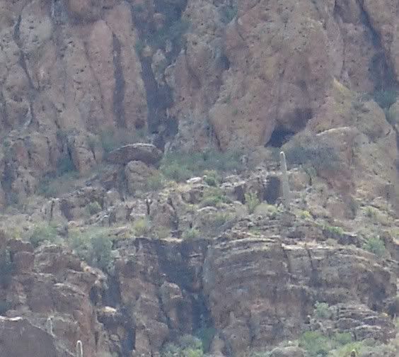
Adolph Ruth was looking for a Mexican clue of a symbol on a hill above the junction of 2 canyons. One canyon was brushy and came in from the East, the other canyon was flanked by high cliffs and came in from the South. I believe this junction is Tortilla Wash and Peters Canyon. The Mule trail comes down the West side of Peters Canyon(see Tom Kollenborns 'trick to the trail' map) goes over this hill East into Tortilla Wash, and then follows Tortilla Wash South. It does not go North as Toms map shows. At the top of this hill are a cut cactus, trail marker, and at least 3 symbols. The area would be cleared except for the trees/brush used to make the symbols. These symbols could be seen from the Heart(above pic #1) and from the Mule trail as it came into Peters Canyon from the SW.
This picture, taken from the South, shows this hill. I have placed dots on the trees that make an arrow symbol.
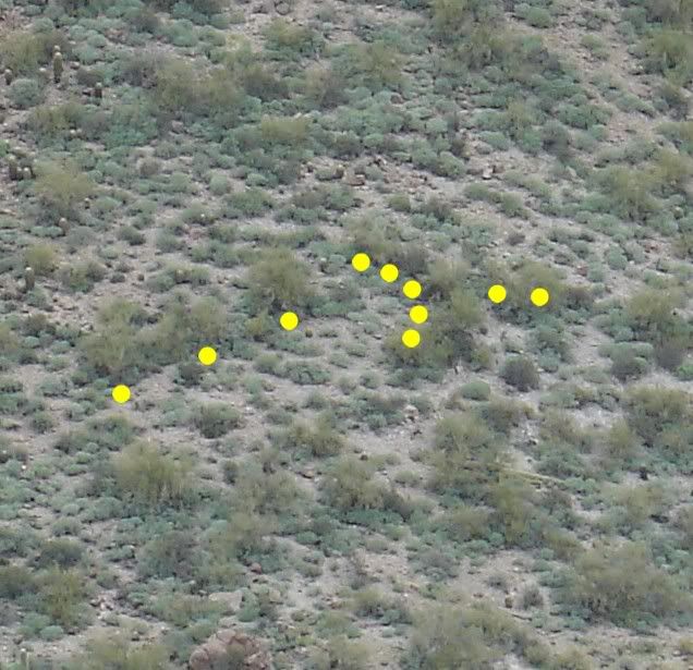
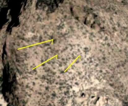
This is a google showing the same hill and 3 symbols, an X, the arrow, and a circle with a dot in the center and a line pointing South, the direction of the Mule trail.
This picture, taken from the South, shows this hill. I have placed dots on the trees that make an arrow symbol.
This is a google showing the same hill and 3 symbols, an X, the arrow, and a circle with a dot in the center and a line pointing South, the direction of the Mule trail.
-
twoguns
- Posts: 16
- Joined: Sat Dec 26, 2009 12:24 am
- anti-spam detector: No
- The middle number please (4): 4
Re: Sombrero Mt.
For cubfan-sorry about the post verbage being deleted-I swear I did not do it 
I would like you email if ok.
To answer a few of your questions on your post... There are many prospects in the mtns.
The Mule trail, trail markers, and additional symbols all lead to this mine. A prospect would
not have this, only a producing mine would. If the mine played out the symbols would have been removed.
Per the Tonto Forest Service, which oversees The Sups. Wilderness. Removing ore from the
shaft would be a violation, even if trying to prove the LDM. A treasure trove/cache permit will not apply to removing ore from the shaft.