Tonto Natural Bridge State Park
Beat Arizona's Summer Heat
Photos and text by Gordon Burhop
About 100 miles northeast of Phoenix, off Arizona State Highway 87, the Mogollon Rim’s forest of ponderosa pine, pinyon, juniper and scrub oak offers some welcome relief from the summer heat of the Sonoran Desert. Here, in the heart of Arizona’s rim country, 5,000 to 6,000 feet in elevation, you will discover three communities with considerable charm, the Tonto Natural Bridge State Park with its imposing natural limestone bridge, and Tonto National Forest’s Fossil Creek Springs Trail.

The community of Payson serves as the gateway to the region. Every year, Payson, the “Festival Capital of Arizona,” hosts, for example, the Classic Auto Show and Swap Meet in May, the Old Timers Rodeo and country music festival in June, the Monsoon 5 K Run in July, the World’s Oldest Continuous Rodeo in August, the State Championship Fiddlers’ Contest in September, the Great Payson Jerky Jamboree and the Fine Art and Crafts Show in October, and the Christmas Tree Lighting in December. The community also offers an annual Concert Under the Stars series, the Rim Country Museum and the educational Shoo-Fly Indian archaeological site. Its two dozen commercial galleries have a broad selection of arts, crafts and antiques.
Some 15 miles northwest of Payson, on State Highway 87, you come to Strawberry, a quaint village where a walk along historic Fossil Creek Road will take you past log structures, aging barns, Arizona’s oldest standing school (now a State Historical Site) and an old cemetery—reminders of the late 19th century pioneering heritage of the region. You will also want to visit the historic Strawberry Lodge, a log structure with a unique bar.

A few miles farther northwest, on Highway 87, you will come to Pine, another quaint village, where another walk will take you past pioneer homes, churches, schools, an early post office and the old community cemetery. Pine celebrates holidays with arts and craft shows, vintage auto shows and parades.

Natural Bridge in Tonto Natural Bridge State Park, AZ.
Photo by Alexys from Getty Images.
Between Payson and Strawberry, on FR 583 off Highway 87, you will find the Tonto Natural Bridge State Park, where the waters of Pine Creek have, over the millennia, carved the largest travertine (limestone) natural bridge in the world. It rises 183 feet above the canyon floor. It runs 400 feet along the creek bottom. The bridge was discovered in 1877 by David Gowan, a Scott, who moved his family there in the 19th century. He built a cabin that is now listed in the National Register of Historic Places. You can explore the bridge and Pine Creek area by three different trails. The Bridge Trail, steep and slick in places, will take you to the creek bottom, where you can walk through the bridge’s tunnel-like arch when the water is low. The River Trail will also take you to the creek bottom, to a place where you can see cave-like stalactites hanging from the bridge arch and from the nearby canyon wall. The Bridge and River Trails have recently been connected. The very short Waterfall Trail takes you to a secluded grotto with water seeps, ferns and travertine formations.

Tonto Natural Bridge State Park- View from inside a cave.
Photo by Kaapro from Getty Images.
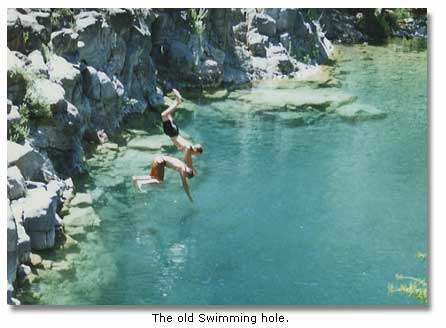
You will find the head of the Fossil Creek Springs Trail on Fossil Creek Road, a few miles out of Strawberry. The creek, named for rich fossil deposits in the nearby sedimentary strata, is fed by abundant permanent springs—unique in this arid region! The springs produce an average flow 1,000,000 gallons per hour, at a steady 72 degrees Fahrenheit, a fine temperature for a swim. The stream nourishes a riparian environment rich in plant and wildlife.
The powerful flow prompted the Arizona Power Company to build a hydroelectric power plant system on the stream early in the 20th century. The system included the Irving and Childs plants and impoundments, pipes and wooden flumes that diverted the stream’s water for use in driving electric turbines. Although the natural flow fell dramatically when the water was diverted, the stream still sustained a relatively lush environment. Arizona Public Service decommissioned the power plant system at the end of 2005, returning the water to its natural stream bed to rejuvenate its environment.
You can hike or bike the trail, or you can drive it with a high clearance vehicle. About two and a half miles from the trailhead, you come first to Fossil Springs and its perfectly clear water, where you can swim and picnic in a lush woodland environment only a couple of hours from the Sonoran Desert. As you proceed down Fossil Creek, you will not only follow the creek bed, you will parallel the historic hydroelectric power system, (much of which has now been removed), and come finally to the Childs plant at the juncture of the creek and the Verde River. Along the way, you will find places to camp, swim, fish and picnic. On the Verde River, a mile upstream from its confluence with Fossil Creek, you will find the secluded site of Verde Hot Springs, which is sometimes occupied by nude swimmers.
From there, you can travel northwest on a gravel road to State Highway 260, then turn west to Camp Verde and Interstate 17 to return to Phoenix. Or you can retrace your path, back up the trail, and return through Payson to Phoenix.
For additional information:
Chamber Of Commerce Pine-Strawberry
3886 N Highway 87
Pine, Arizona 85544
Ph 1-928-426-3547
Tonto Natural Bridge State Park
P.O. Box 1245
Payson, Arizona 85547
Ph 1-928-476-4202
Fax 1-928-476-2264


Share this page on Facebook:
The Desert Environment
The North American Deserts
Desert Geological Terms


