Page 5 of 14
Re: CIBOLA ZUNI TRIP - silent hunter
Posted: Tue Apr 13, 2010 6:27 pm
by silent hunter
Re: CIBOLA ZUNI TRIP - silent hunter
Posted: Tue Apr 13, 2010 6:30 pm
by silent hunter
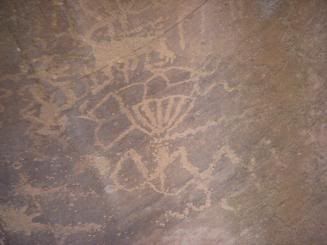
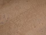
Could this be mans best friend!!! These are all photos from the zig zag canyon. I hope you enjoy them.
Re: CIBOLA ZUNI TRIP - silent hunter
Posted: Tue Apr 13, 2010 6:42 pm
by silent hunter
As I walked the canyon and photographed the drawings I realized they were a map. Not just a map, but a map of mexico, arizona, new mexico, utah, colorado, and california.
They were drawn from one point to another and back to where you started, that way they could be used both ways. They were very simple lines and very simple land marks. I will include some of them next.
Re: CIBOLA ZUNI TRIP - silent hunter
Posted: Tue Apr 13, 2010 6:51 pm
by silent hunter
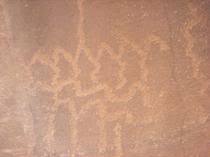
This is where I started to become A Duchman Hunter.
This is where the four peaks line up with a river close to the superstition mountains and the trail across the river and up into a creek
It's a map of a river close by the superstition mountains were the four peaks line up to the bends. And this is the spot were the Indians would cross. I cut the photo short to avoid the rest of the trail. These are just parts of maps.
Re: CIBOLA ZUNI TRIP - silent hunter
Posted: Tue Apr 13, 2010 7:02 pm
by silent hunter
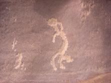
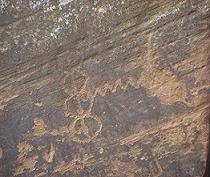
This was cool to see!! All the other drawings were of cactus and desert,but this one was pine trees.
Re: CIBOLA ZUNI TRIP - silent hunter
Posted: Tue Apr 13, 2010 7:05 pm
by silent hunter
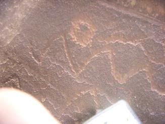
This is the spot were i became A Lost Duchman Hunter.
Re: CIBOLA ZUNI TRIP - silent hunter
Posted: Tue Apr 13, 2010 7:13 pm
by Jim Hatt
Kurt,
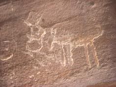
I can see where they are starting to look like maps now! I was beginning to wonder about some of those animal glyphs.
Between you and me and cubfan and Guz and your wife, we will eventually get this story out there for everyone.

~Hattman~
Re: CIBOLA ZUNI TRIP - silent hunter
Posted: Wed Apr 14, 2010 6:51 am
by silent hunter
This is the trail from cibique mountain to the four peak area. From the top of cibicue mountain you can see the four peaks. Notice the circle. There is a huge round wall on the east side of the four peaks this is it.
Re: CIBOLA ZUNI TRIP - silent hunter
Posted: Wed Apr 14, 2010 6:56 am
by silent hunter
This is were things get real cool because this map I found hidden behind a walled up cave along the little colorado river (The old route).
Re: CIBOLA ZUNI TRIP - silent hunter
Posted: Wed Apr 14, 2010 6:59 am
by silent hunter
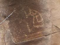
I still look at this one every week. What is it???