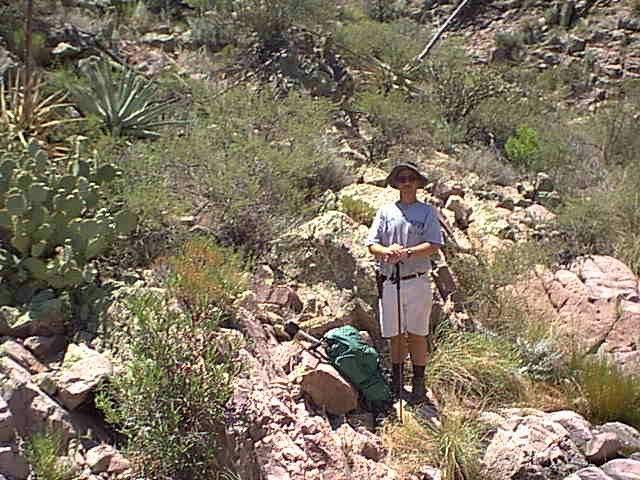
This is a photo I took of Tim just after we reached the top of the canyon, and just before we found the JF Trail.
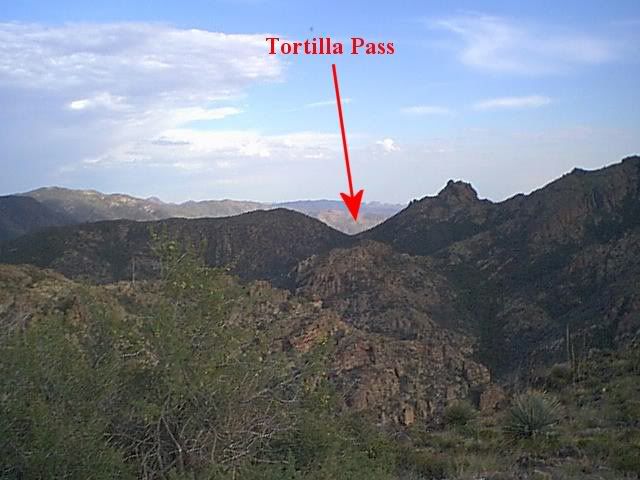
Looking South towards Tortilla Pass, from the same place where I took the photo of Tim.
We started walking North on the JF Trail towards the Tortilla trailhead where my truck was parked. We hadn’t gone more than 1/8 to 1/4 of a mile when I paused to look at the canyon directly west of where we were on the trail. Across the canyon I saw a large boulder maybe 30 feet high that caught my attention. I stared at it for at least a full minute trying to figure out where I had seen that shape before. Nothing came to mind except Weaver’s Needle. I finally shook it off and we resumed our trip back to my truck.
It was several weeks later when I was going through some old maps in my collection, that I came across one that made me freeze for a moment, because of a shape that it had drawn on it. The map was one that has “June 1860 Peralto” on it. That shape was exactly like the one I had seen from the JF Trail when Tim and I were up there.
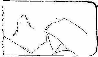
The map has two parts. It is only part 1 that has the shape that caught my interest on it and makes any sense for fitting the area where I saw the large boulder with that shape. NOTE: North would be to the right on the map below and it would have to be rotated 90 degrees clockwise to match the area where I think it applies.
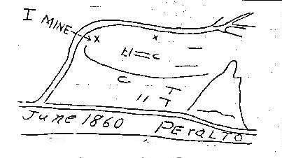
If you look at the map above. The long canyon above the words June 1860 Peralto and consider it to be Tortilla Creek, (Which is the heavy blue line on the topo map in the next photo below) and the other canyon with a bend in it where the X’s are to be a tributary of Tortilla Creek. Several things fall into place. There are two X’s on the map. The one that has an arrow pointing to it from the word MINE is, would be located right where the Milk Ranch Mining Claims were located. See: Myths and Truths about Mining in a Wilderness Area located at: http://www.desertusa.com/mb3/viewtopic. ... 42&start=0
The other X to the right of it is about where I saw the large boulder shaped like the tall narrow shape located in the bottom right corner of the Peralto Map. See points numbered as 1 & 2 on the map below.
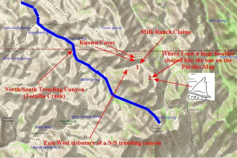
I spent many hours comparing the Peralto Map, with my knowledge of the area North of Tortilla Pass, before I managed to orient the map correctly, to put everything where it should fit in the field. I made several trips to the canyon I believed to be the canyon shown on both maps, and never found any mine tunnels or shafts. But, I did find that there was fair amounts of gold that could be recovered from the area where that canyon enters Tortilla creek.
Being convinced that I understood how and where the Peralto map fit in the mountains, I started comparing the lay of the land there to traditional “Dutchman” and various other clues of legend and lore, to try to figure out if there was a lost mine story that aligned with this location.
The clues/landmarks I came up with that fit were:
It is in an East/West tributary of a North/South Trending canyon.
From the top of the hill above the mine I can see Weaver’s Needle.
There is a cave 200 yards across from the Mine.
That is about all that really fit the location, but they were worth looking into a little deeper.
Jacob Waltz (according to Herman Petrasch) never made a map to his mine for Julia and Rhiney. But he did make some doodles on the pages of a stamp booklet for them that showed what some of the things he described to them looked like.
The doodle below was found on Herman’s fire place mantle after he died and is believed to be one that Jacob Waltz made.
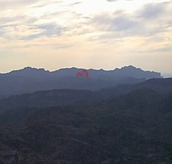
There are several places in the area of the Milk Ranch Claims where Weaver’s Needle can be seen from. I only have one photo that was taken from the trail above and North of the Milk Ranch Claims. I had to outline Weavers Needle in red because it was so difficult to see with Superstition Mountain behind it. The shape is correct when compared with the doodle drawing Waltz made, but the other things in the doodle are not in the photo below. It is possible that if I went to the top of the hill south of the Milk Ranch claims and looked around, I might find a place where the scenery would match up with the doodle. I have not done that, but may still get back there and try it someday.
Photo of Weaver's Needle taken from a point ON the JF Trail North of the Milk Ranch Claims.
I have a feeling that if someone spent a lot more time in that area than I did, and got to know it intimately, they could put together an ever stronger case for the possibility of it being the location of one of a Lost Peralta Mine (especially the June 1860 Peralto Mine) and possibly even the Lost Dutchman.
Before you get too excited about it. I have at least 3 other locations where I can make just as strong a case for the "Dutchman". But no other place that fits the June 1860 Peralto Map like this one does.
I lost interest in this location when I went to the BLM and researched to see if there had ever been any mining claims in this area, and found out that there were two valid and ACTIVE mining claims on it. It is NEVER a good idea to go climbing around on someone Else's active mining claim. Especially in an area as remote as that one is! (This was in 2002).
When I was in the BLM office last week researching Bilbrey's Mining Claims, I took another look at the Milk Ranch records and found that the claims have expired and not been renewed. If I were 10 years younger, I would invest some serious time in this area. I don't know where the actual diggings were on the Milk Ranch Claims, or why they were allowed to expire. But those claim's were VALIDATED and remained active within the boundaries of the Wilderness Area, so there has to be something of value there.
If anyone does go back there and finds anything of interest that I overlooked. I would love to hear about it. (Link to my e-mail address: http://www.desertusa.com/mb3/viewtopic. ... 169#p12169). I give my word that I will not discuss anything you tell me, with anyone else, or on this website without your permission.
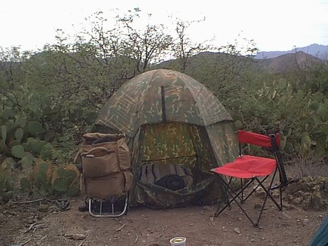
Our campsite off the side of the JF Trail on the ridge above the Milk Ranch Claims.
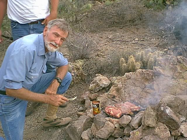
Clay's favorite meal the first night in camp.
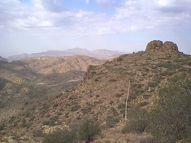
View of the area above the Milk Ranch Claims
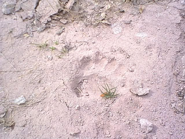
Bear track we found in a sandy wash below the Milk Ranch Claims
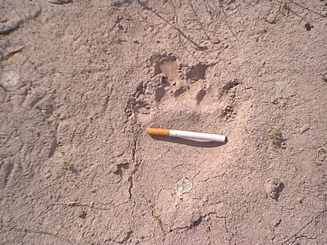
Another bear track with a 100mm cigarette in it for scale.
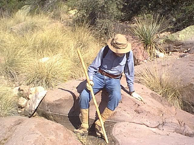
Clay resting near the Bear tracks.
Jim Hatt