Tommy,
What exactly would you and your buddies do to make that trail more passable? It would take a LOT of boulder stacking or heavy equipment to really make that trail stock/mildly modified 4wd friendly. I think I am going to head back out there on Monday to look for piggies and explore some of the areas I haven't seen around Mud Mtn.
Parashant
Moderator: Jim_b
-
Tommy
- Posts: 46
- Joined: Fri May 29, 2009 6:45 am
- anti-spam detector: No
- The middle number please (4): 4
Re: Parashant
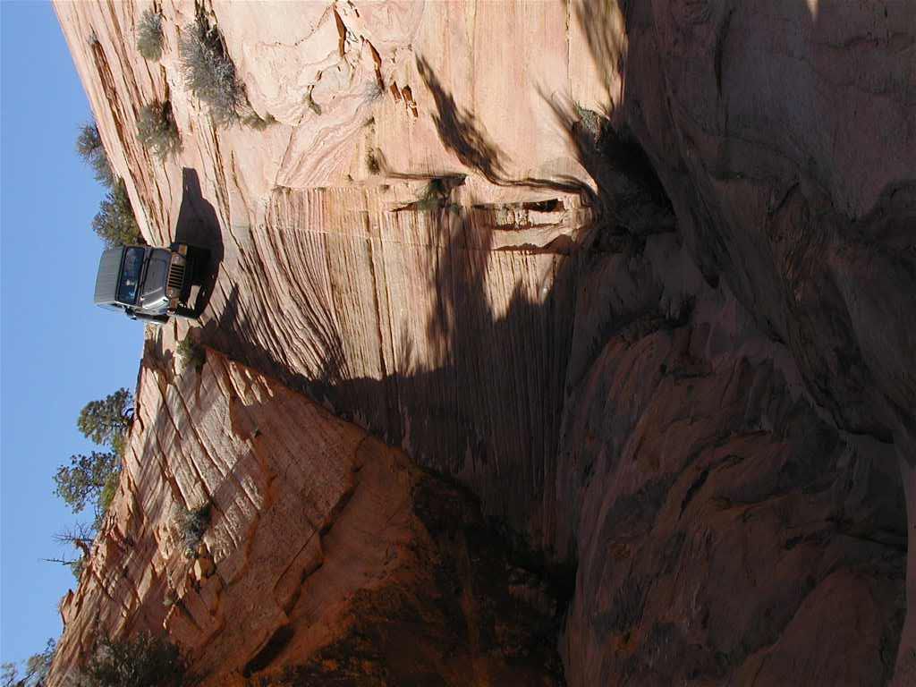
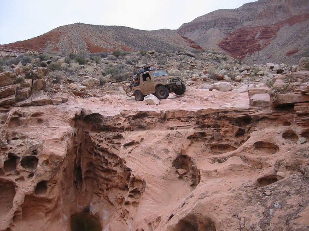
It only has to be this good to get a stock Jeep through it.
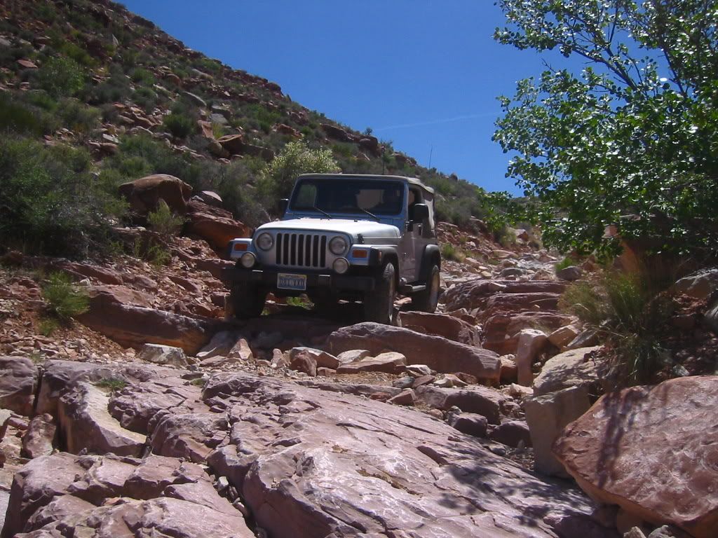
We went down only because we got on the plateau from a more Northerly route but another stock Jeep made it up
This is the road from the Savanic mine up to the plateau. It is very scenic and not too difficult up to this point (as long as you don't mind shelf roads with several hundred foot cliffs.)
A ranger politely informed us that some of the roads in this area are closed but not marked. He gave us another route to get here. Basically they don't want us in the Gyp Hills area.
-
Tommy
- Posts: 46
- Joined: Fri May 29, 2009 6:45 am
- anti-spam detector: No
- The middle number please (4): 4
Re: Parashant
Here is the ranger's response to our inquiry about a suggested route:
Savanic..... We would prefer that people use a route that does not go
through the NPS lands at Gyp Hills. There are BLM roads that go east from
Mohave County Road 113 to Black Willow Spring and then again east from
Black Willow Spring then come back to the south and connect to the road to
Savanic Mine east of the NPS boundary. The road miles for each route are
essentially equal at about 16 miles. I did not plot any GPS coordinates
of intersections but I could. Currently there are no signs up reflecting
the road closures on NPS lands, however, signage and gates should be
forthcoming within the next fiscal year
So far I have been very satisfied with all of our conversations and correspondance with the Rangers in this area. I really liked the Ranger who was at Toroweep until about a year ago. I haven't met his replacement. He wasn't there the three times I've been there in the last year.
-
NissanBoy
- Posts: 52
- Joined: Tue Jul 14, 2009 8:47 pm
- anti-spam detector: No
- The middle number please (4): 4
Re: Parashant
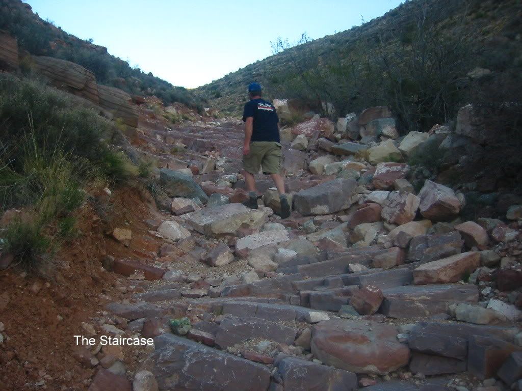
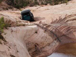
Is there an exact route number for the "staircase" route near Savanic mine? That staircase looks like it would actually be a lot of fun and maybe even doable with a stock 4wd with an experienced driver!
This summer when I was on enduro trying to navigate through Grand Gulch Canyon it was tough, but not impassable. I just didn't want to risk dropping my bike and breaking open a radiator in the middle of July. 105 degrees + broken rad = overheated bike instantly, if you know what I mean. I have also hiked into grand gulch canyon from the east side and it was pretty tough looking the 1/4 mile or so that we hiked. You had mentioned you tried it in a Sammy with locked 35's on it and it wasn't too bad, right?
If I didn't have a wife and a newborn I think I would going to Parashant every other weekend! I can't wait till my boy grows up a little bit. He will hopefully make an excellent co-driver someday for my AZ strip adventures.
Love the pics by the way keep them coming!
-
Tommy
- Posts: 46
- Joined: Fri May 29, 2009 6:45 am
- anti-spam detector: No
- The middle number please (4): 4
Re: Parashant
I don't know the number of the Savanic route. I let someone borrow my map with the route numbers and never got it back. I stopped by the BLM office in St. George today to get a new one but they are closed on Sunday, of course. It is a bit south of the Grand Gulch Canyon and the staircase starts right at the mine and looks like that all the way to the top which is about .5 mi,IIRC. Below the mine is not hard at all as long as you don't mind narrow shelf roads.
I drove Grand Gulch Canyon from the bottom up and I thought I could see the top but a friend of mine was at the top trying to reach us by CB to tell us that it was impassable. He said the very top was really bad. I hoped to check it out from the top on this trip but it was too far out of the way..
I drove down to the end of Whitmore and hiked down to Frog Spring. The route in my GPS sucked. I found the old CCC trail on the way up and it's much better but parts of it are missing and it's hard to stay on the trail.
From there I took a road that went from near the Bar10 to the top of Mt. Logan. My phone starting flashing when I got to the top. It was two days worth of missed calls and texts. I was so exited to find a spot out there that my phone worked (Verizon) that I called my buddy and didn't even notice the mountain was on fire...
The fire was to the north of me and the south is pretty much a cliff. I hightailed it out of there. My buddy called Paul the ranger and he said they were doing a controlled burn. It looked like a pretty big fire to me.
Toroweep campground was full so I went into Kanab and got a room because I was sore. I left home in a hurry and forgot a lot of my camping gear. I recently moved and forgot that my stuff wasn't ready to go like it usually is. So I slept in the front seat the first night which isn't too bad even though I'm 6'2". I also wanted to load some tracks into the laptop from the GPS and tidy them up so I can share them. I also had ideas about exploring an area that was new to me...
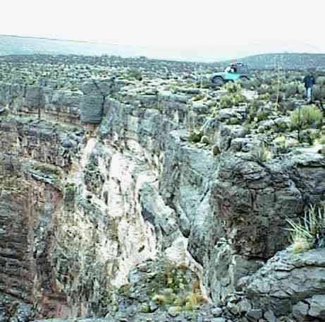
I looked around a little in the area to the SW of Coral Pink Sand Dunes. It's beautiful but very sandy. I will definitely be back to check it out. I didn't bring a camera on this trip but here is a picture my dad took in what might be an off limits area. I don't believe it was at the time and I'm not sure if it is now or not...
I drove Grand Gulch Canyon from the bottom up and I thought I could see the top but a friend of mine was at the top trying to reach us by CB to tell us that it was impassable. He said the very top was really bad. I hoped to check it out from the top on this trip but it was too far out of the way..
I drove down to the end of Whitmore and hiked down to Frog Spring. The route in my GPS sucked. I found the old CCC trail on the way up and it's much better but parts of it are missing and it's hard to stay on the trail.
From there I took a road that went from near the Bar10 to the top of Mt. Logan. My phone starting flashing when I got to the top. It was two days worth of missed calls and texts. I was so exited to find a spot out there that my phone worked (Verizon) that I called my buddy and didn't even notice the mountain was on fire...
The fire was to the north of me and the south is pretty much a cliff. I hightailed it out of there. My buddy called Paul the ranger and he said they were doing a controlled burn. It looked like a pretty big fire to me.
Toroweep campground was full so I went into Kanab and got a room because I was sore. I left home in a hurry and forgot a lot of my camping gear. I recently moved and forgot that my stuff wasn't ready to go like it usually is. So I slept in the front seat the first night which isn't too bad even though I'm 6'2". I also wanted to load some tracks into the laptop from the GPS and tidy them up so I can share them. I also had ideas about exploring an area that was new to me...
I looked around a little in the area to the SW of Coral Pink Sand Dunes. It's beautiful but very sandy. I will definitely be back to check it out. I didn't bring a camera on this trip but here is a picture my dad took in what might be an off limits area. I don't believe it was at the time and I'm not sure if it is now or not...
-
NissanBoy
- Posts: 52
- Joined: Tue Jul 14, 2009 8:47 pm
- anti-spam detector: No
- The middle number please (4): 4
Re: Parashant
Ok there was a lot of info in that last post Tommy. I understand the part about Grand Gulch Canyon. The part I hiked down would be the part your buddy was telling you about being impassable. I would agree, but after seeing what people can do with the right rigs at Hump and Bump this weekend my definition of impassable has changed greatly!
When were you out there hiking and dodging fires? Was it all the same trip as the "staircase" trip or not?
I am heading out early tomorrow for a day trip on my quad around the NW part of Parashant. I will start up Elbow Canyon and bum around the higher elevations just south of the Virgin River Gorge. As always I will post photos from tomorrow as soon as I have them available.
-
Tommy
- Posts: 46
- Joined: Fri May 29, 2009 6:45 am
- anti-spam detector: No
- The middle number please (4): 4
Re: Parashant
I guess my last post was a bit confusing 
The part about the Grand Gulch Canyon was May of 08, in the Samurai. In the years prior to that it had been passable in a Jeep Wagoneer, a stock Toyota truck, etc. We tried again last year, hoping other groups had been through there and done a few improvements. We went up and around because it still looked pretty bad for our rigs. On the way out we went down the Savanic. That was last May.
I was hiking and dodging fires this weekend...
The area you are going to is fun but very rocky. The meadow at the top of Black Rock Mountain used to be absolutely beautiful before it all burned. The last time I camped up there we were awakened by the sound of something digging through our stuff. It turned out to be a couple of horses. They wouldn't go away. We tried everything! Finally we cranked up Pantera and that did the trick...
There is a cave to explore a few miles southeast of there. I can't tell you exactly where it is but it's on TOPO maps. Even with coordinates it can be hard to find if the road hasn't been used recently.
Here's a familiar site if you're going up Elbow Canyon.
I've always wanted to see a good picture of this place with the cabins still there.
This is the campsite I originally gave directions to at the top of Snap Canyon:
-
NissanBoy
- Posts: 52
- Joined: Tue Jul 14, 2009 8:47 pm
- anti-spam detector: No
- The middle number please (4): 4
Re: Parashant
Dang Tommy! Is there a part of Parashant that you donnt know like the back of your hand? That photo with all the rigs in Elbow Canyon is where we saw a good size rattlesnake back in July hiding by one of the big rocks by the old foundation. I went up to Black Mtn today and it is still pretty scenic up there, but I could imagine before the fires it was probably very spectacular! I saw a couple of bucks up there right by the boundary of Paiute Wilderness preserve.
I continued on towards Low Mtn, but due to the extreme rockiness and the fact that I could see St George in the distance it seemed far enough for me. As always I had a ton of fun today, even if it was by myself. Coming down Elbow Canyon in the quad beat the piss out of me for sure! I don't know when you took the photo, but that road going up Elbow is getting pretty rough! I don't know if my Pathfinder would make it up that easily. I will post some photos when I have a chance.
Are you all ready for your turkey day trip in a couple of weeks?
For those that don't know what Tommy and I are talking about I took AZ County 299 up through Elbow Canyon. It starts at about 2000' and goes to 6500' in about 8 miles. Some portions are pretty steep switchbacks with ruts and loose gravel. From there I took BLM 1004 through the Paiute Wilderness towards Black
-
NissanBoy
- Posts: 52
- Joined: Tue Jul 14, 2009 8:47 pm
- anti-spam detector: No
- The middle number please (4): 4
Re: Parashant
Rock Mtn. It is a little rocky in some parts but once I reached the meadows as Tommy refers to it the road smoothed out quite considerably.
I can't wait to make it back out there. I just grabbed some lift coil springs for my Pathfinder and I am hoping to install a front locker here in the next week or two. I will definitely have to test it here sooner than later. I just need to find some buds to bring along. After my other pal rolled his truck out there, both him and his passenger have been grounded by their wives from Parashant. That is my opinion is the most tragic part of it all!
I can't wait to make it back out there. I just grabbed some lift coil springs for my Pathfinder and I am hoping to install a front locker here in the next week or two. I will definitely have to test it here sooner than later. I just need to find some buds to bring along. After my other pal rolled his truck out there, both him and his passenger have been grounded by their wives from Parashant. That is my opinion is the most tragic part of it all!
-
Tommy
- Posts: 46
- Joined: Fri May 29, 2009 6:45 am
- anti-spam detector: No
- The middle number please (4): 4
Re: Parashant
I just went up Elbow canyon the weekend I ran into you. It was a little beat up, but it gets much worse. Often during the spring snowmelt there will be huge ruts and washed out parts of the road. The time we were pestered by the horses we spent a good hour and a half in two different spots doing road repairs.
I hope the meadow will be back to its former glory this spring. Usually the grass is very green and park like which makes the trees appear much healthier.
I must have seen five different herd of deer, with 5 to 7 in each, when I drove through Mt. Logan wilderness area Saturday. Most of them didn't even react when they saw me. I'm guessing there is no hunting permitted in this area?
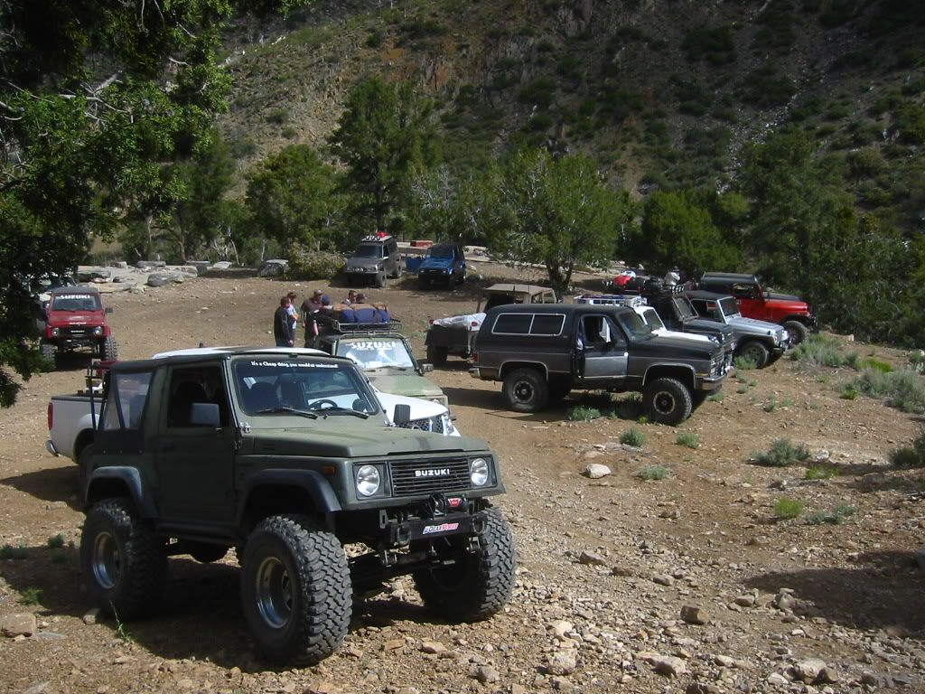
If you look closely in the Elbow Canyon photo you can see a Nissan truck that goes with us on some of our trips. He even drove down the staircase at the Savanic! We call him Nissan Pete... and other things when he has too much Tequila! It's lifted, has skid plates and does surprisingly well.
Let me know when you want to take a trip again. I'll probably be up to it. They do lock the gate that's a little ways past Elbow Canyon at the first sign of snow and they don't open it until spring. One year they did it Thanksgiving weekend after we passed through.
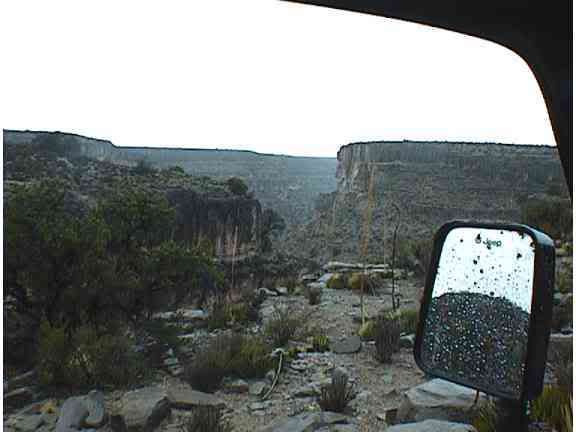
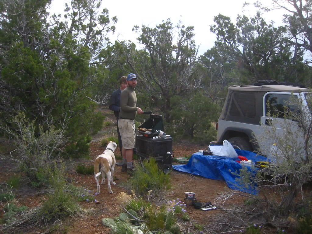
This picture has nothing to do with the area we are talking about. I just like it...
This is past the Copper Mountain Mine near Mollie's Nipple.
I hope the meadow will be back to its former glory this spring. Usually the grass is very green and park like which makes the trees appear much healthier.
I must have seen five different herd of deer, with 5 to 7 in each, when I drove through Mt. Logan wilderness area Saturday. Most of them didn't even react when they saw me. I'm guessing there is no hunting permitted in this area?
If you look closely in the Elbow Canyon photo you can see a Nissan truck that goes with us on some of our trips. He even drove down the staircase at the Savanic! We call him Nissan Pete... and other things when he has too much Tequila! It's lifted, has skid plates and does surprisingly well.
Let me know when you want to take a trip again. I'll probably be up to it. They do lock the gate that's a little ways past Elbow Canyon at the first sign of snow and they don't open it until spring. One year they did it Thanksgiving weekend after we passed through.
This picture has nothing to do with the area we are talking about. I just like it...
This is past the Copper Mountain Mine near Mollie's Nipple.