St. George, Utah
Western Gateway to Zion National Park
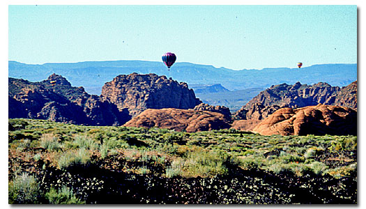
Snow Canyon Stat Park - 11 miles west of St George
Location / Description
St. George, Utah also called "Dixie," is situated in the extreme southwestern corner of Utah, at the northernmost extension of the Mojave Desert. Its location on Interstate 15 makes it the western gateway to Zion and many other Utah national parks and monuments. The combination of the warm, dry winter climate and natural beauty of the setting draws both new residents and tourists to the area. 65 square miles
Population / Elevation
100,000 / 2,860 feet above sea level
Weather / Climate
St. George, Utah is located within the northern extension of the Mojave Desert. This Southwestern setting, and its low elevation, provide St. George with a desert climate characterized by low humidity (rapid evaporation), generally clear skies, relatively mild winters and hot summers. The average annual temperature is approximately 61 degrees F. Average annual precipitation is approximately 8 inches per year.
| St. George, Utah - Monthly Climate Normals | |||||||||||||
| Year | Jan | Feb | Mar | Apr | May | Jun | Jul | Aug | Sep | Oct | Nov | Dec | |
| High °F | 78.0 |
53.5 |
60.3 |
68.1 |
77.1 |
86.2 |
95.9 |
102.0 |
99.8 |
93.2 |
80.5 |
64.8 |
54.3 |
| Low °F | 45.9 |
27.1 |
31.7 |
37.5 |
44.2 |
52.4 |
60.3 |
67.8 |
66.4 |
57.1 |
45.0 |
33.2 |
27.4 |
| Avg °F | 62.0 | 40.3 | 44.0 | 52.8 | 61.0 | 69.3 | 78.1 | 84.9 | 83.1 | 75.2 | 62.8 | 49.0 | 40.9 |
| Rain | 8.14 |
1.10 |
1.00 |
1.00 |
0.48 |
0.40 |
0.20 |
0.56 |
0.68 |
0.59 |
0.62 |
0.70 |
0.82 |
History
Saint George was settled by Mormons, about 1861, sent by Brigham Young to grow cotton. Many people believe that St. George itself was named in honor of George A. Smith,
Cotton farming, as well as processing at the Washington Cotton Mill, continued until after the Civil War, when the South was once again able to provide the Utah region with cotton. The St. George, Ut Mormon Temple, built between 1869-77, was the first first Mormon Temple built in Utah. The temple and several other historical buildings are still standing.
Things To Do
St. George, Ut. is known as a winter haven for what the 45,000 locals like to call "Snow Birds" (tourists who come to St. George to warm up away from the snow). St. George becomes a Mecca for vacationing college students who go south for an early taste of summer away from the snow. At such times, St. George Blvd. becomes THE place for every college student to see and be seen (avoid driving on St. George Blvd. at all costs during Spring Break - unless you have a lot of time).
World-class dinosaur site includes a rare combination of fossilized bones and footprints of dinosaurs and many other ancient animals. St. George Dinosaur Discovery Site at Johnson Farm is a must see for anyone interested in dinosaurs, geology and the ancient Jurassic world.
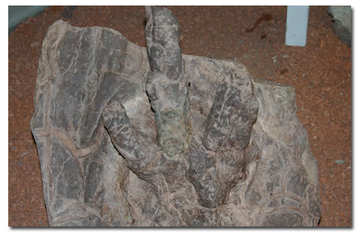
Dinosaur Discovery Site at Johnson Farm located in St George
There are walking/biking paths throughout St. George city where you can walk/run/bike in beautiful scenic area on these connecting trails. St. George and Zion National Park offer perhaps the greatest variety of biking, hiking, and rock climbing opportunities found anywhere in the United States.
Rosenbruch Wildlife Museum - Nearly 300 animals are displayed in their natural habitats. Almost a quarter mile of mountain pathway winds through the plains of Africa, forests of North America and mountains of Asia. A two-story mountain with two waterfalls and periodic thunder and lightning storms, provide an experience to be remembered.
Hotels/motels
There is something for every taste and price range. For more information and a complete list. Click Here. (Hotel Rates, availability, reviews and reservation online)
Camping & RV Parks
There are many commercial and public locations for camping and RVs in and near St. George. For a complete list contact:
- St. George Chamber of Commerce
97 E. St. George Blvd.
St. George, UT 84770
435-628-1658
Resources & Nearby Attractions
Resources
Cities & Towns
Springdale, Utah: 42 miles northeast.
Cedar City, Utah: 51 miles north.
Beaver, Utah: 102 miles north.
Hurricane, Utah: 17 miles east.
Kanab, Utah: 79 miles east.
Fredonia, Arizona: 72 miles east.
Mesquite, Nevada: 44 miles south.
Las Vegas, Nevada: 118 miles southwest.
Parks & Monuments
Wilderness & Recreation Areas
Lake Mead National Recreation Area: 86 miles southwest.
Glen Canyon National Recreation Area: 114 miles east.
Dixie National Forest: 20 miles east.
Historic & Points of Interest
St. George Art Museum (within the city)
Dixie College (within the city)
Brigham Young Winter Home (within the city)
Daughters of Pioneers Museum (within the city)
Jacob Hamblin Home (within the city)


Share this page on Facebook:
The Desert Environment
The North American Deserts
Desert Geological Terms


