Bitter Springs Trail
- A Nevada Backcountry Byway -
Text and photos by Len Wilcox
Author, Desert Dancing
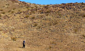
Desert mountains, an historic wagon road, an intermittent spring, extraordinary rock formations and, sometimes, bighorn sheep and wild horses.

Bitter Springs Trail, a BLM Backcountry Byway, has all this and more. It's a twenty-eight mile, two-hour journey through the Muddy Mountains of Nevada, an easy day trip when you want a break from the casinos and night life of Las Vegas. It's marked on most maps and is located about forty miles east of Las Vegas, south of Interstate Highway 15, and west of Valley of Fire State Park.
To reach the trail, proceed north from Las Vegas on Interstate 15 to the Valley of Fire exit (exit 75), and turn south (right) toward the state park. Go past the Moapa Indian Reservation store. About three miles later, the paved road bends left, but follow the trail straight, to the mountains. A BLM sign lets you know you that you have reached the Bitter Springs Back-country Byway.
The first half of the trail is a graded, improved road that ends at an open rock quarry near the summit of the pass, about eight miles from pavement. This segment can be driven in a passenger car. About a mile after leaving the pavement, you will cross an ancient and barren set of tracks: the old Spanish Trail, known later as the Mormon Road, first traveled by Spanish explorers in 1776. The Spanish used it as a link between their New Mexico and California missions. Later, the mountain men followed the trail to California. The Mormons developed the trail into a road during their westward expansion after settling in Utah.

You will next climb into the Muddy Mountains and past yellow and red sandstone formations which are similar to the magnificent rocks in the nearby Valley of Fire. The formations are known as the Buffington Pockets, natural basins which trap rainwater, a Godsend for early travelers and their animals as well as for the wildlife, including bighorn sheep and the more modern wild horses. These beautiful sandstone outcroppings, tinted by iron ore and other minerals, are a startling contrast to the limestone hills of the Muddy Mountains.

Once you reach the quarry, the road bends to the right and becomes an unimproved trail. (The quarry may be in operation. If so, be sure that machinery operators see you before you drive through.) From here on, you will need a high-clearance vehicle to drive the trail. Most sport-utility vehicles should be able to make the trip. You may need to drop into four-wheel drive and even use low-range gears to reduce the braking load as you drop down from the pass into Hidden Valley.
 Several trails take off to mines on the right, but following the Backcountry Byway signs, you'll soon descend into a wash. For the next ten miles, the sand can be a problem, first through Hidden Valley and later, through Echo Wash. If the sand becomes a significant problem, it may be a good idea to partially deflate your tires, to about one third to one half of normal pressure, before you proceed. If you do, remember to re-inflate them as soon as possible.
BLM signs seem to disappear for a while, so read and follow your maps. As long as you continue heading east and south you will eventually come to the North Shore Road, which is paved. On this road, you can either head northeast to Valley of Fire State Park (five dollars admission, tremendous scenery, highly recommended) or west to Henderson and Las Vegas.
The next time you're vacationing in Las Vegas, remember Bitter Springs. And don't forget your camera. Stay safe and keep away from open tunnels and mineshafts. Primitive camping is available along the byway. For some this may be a very difficult drive, use care.
Related Pages
Auto Touring & Off-Roading
Share this page on Facebook:
DesertUSA Newsletter -- We send articles on hiking, camping and places to explore, as well as animals, wildflower reports, plant information and much more. Sign up below or read more about the DesertUSA newsletter here. (It's Free.)
The Desert Environment
The North American Deserts
Desert Geological Terms


