The Bradshaw Trail
The Gold Road to La Paz

The Bradshaw Trail, also known as the Gold Road to La Paz, is located in California's southeastern Riverside County. The trail was created in 1862 by William Bradshaw, and was the first trail that crossed the Riverside County desert all the way to the Colorado River. In 1863 it became a well-traveled overland stage route. Originating in San Bernardino, the trail was used to haul miners and other passengers to the gold fields at La Paz, Arizona (now Ehrenberg).
You can still explore about 70 miles of the Bradshaw Trail. The county grades the route on occasion, but you'll need a four-wheel-drive vehicle to negotiate stretches of soft desert sand.
The trail takes you through a rock hound's paradise and offers spectacular views of the Chuckwalla Bench, Orocopia, Chuckwalla and the Mule Mountains. Wildlife viewing, bird watching, rock hounding, and hiking opportunities are plentiful along this road.
History of the Bradshaw Trail
Powell Weaver, a scout and a trapper, found gold at a place called La Paz on January 12, 1862. William Bradshaw, a veteran of the California gold rush, knew that Weaver's strike lay on the Arizona side of the Colorado River, about 250 miles east of Los Angeles. Bradshaw figured that gold prospectors would need a new direct trail east from the Los Angeles area across the desert to reach Weaver's strike. He also knew the kinds of opportunities that could be found in a boom. In May of 1862, Bradshaw recruited eight men to scout out the most direct route to La Paz. Indians provided Bradshaw with a map showing an ancient Halchidoma Indian trade route through the Colorado Desert.

Bradshaw followed a 180-mile long route that first took him and his party southeastward to the northern end of the Salton Sink, a deep desert basin (more than 200 feet below sea level) alternatively fed and abandoned over the centuries by the wandering Colorado River.
 The trail turned due east to the Orocopia Mountain foothills and to Dos Palmas, where two springs supplied an abundance of good water. Leaving Dos Palmas, the route filed eastward through the pass between the Orocopia and Chocolate mountain ranges. It skirted the southern end of the Chuckwalla range, then crossed through a gap in the Mule Mountains. From there, it descended into the welcome embrace of the Palo Verde Valley and the Colorado River.
Within months, Bradshaw saw the beginning of a classic boom. Gold miners, freighters, stagecoach companies and travelers from the Los Angeles area began using his trail and, inevitably, his expensive ferry service to the new gold fields.
By 1870, the army of miners had already gleaned most of the gold-bearing ore from the soil and stone of La Paz. They began to leave, some with gold in their pockets, others with nothing but desert sand, to pursue new dreams.
Places to Explore along the Trail
- N. Black Hill Geode Beds
- Black Agate Thunderegg Mine
- Black Agate Hills
- Cinnamon Geode Beds
- Coon Hollow Camping
- Hauser Geode Beds - BLM
- McCoy Mountains Limonite Cubes
- Opal Hill Mine –BLM
- Potato Patch
Camping
Wiley's Well Campground, a BLM Long-Term Visitor Area (LTVA) facility, is located just north of the Bradshaw Trail at its intersection with Wiley's Well Road. The campground has individual campsites with picnic tables, shade ramadas and grills, but potable water is not supplied. Handicapped-accessible restrooms are available in the campground. A fee is charged for overnight use.
Coon Hollow Campground, also a BLM Long-Term Visitor Area (LTVA) facility, is located about three miles south of the Bradshaw Trail on Wiley's Well Road. A fee is required for overnight use. Facilities at this campground are the same as those at Wiley's Well.
Campgrounds can also be found at Corn Springs Campground (a BLM Short-Term Visitor Area). Take the Corn Springs exit off I-10 near Desert Center.

Lodging
There are hotels and motels in Blythe, CA with something for every taste and price range. For more information and a complete list, click here. (Rates, availability and reservations online.)
NOTE: The Chocolate Mountains Aerial Gunnery Range borders a part of the Bradshaw Trail to the south. This is a live bombing range and posted as closed to public entry. DO NOT ENTER THE BOMBING RANGE.
Summers can be extremely hot. Carry plenty of water and extra food. If you are stranded, stay with your vehicle. Always tell someone your plans, and stick to your itinerary.
Cell phones may not work in many areas of the Bradshaw Trail.
Four-wheel-drive vehicles are recommended.
Directions:
From Indio, take State Highway 111 east about 23 miles to the Salton Sea State Recreation Area. Across from Park Headquarters is Parkside Drive. Turn left on Parkview Drive for about 1.7 miles, then left on Desert Aire for about 0.5 miles to the canal road. Follow the canal road for about 10 miles to Drop 24 and the beginning of the Bradshaw Trail.
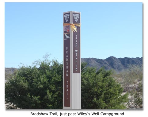
From Blythe, take Interstate 10 west for about 17 miles to the Wiley's Well exit. Go south (left) on Wiley's Well Road for about 9 miles to its intersection with the Bradshaw Trail, just past Wiley's Well Campground. Turn right and proceed west towards Indio. Starting at the Bradshaw Trail's end near Ripley is not recommended due to its rerouting through and around agricultural fields on private land.
Books about the Bradshaw Trail
Gold Road to La Paz - Lots of maps and history
Gem Trails of Southern California - Guide to collecting sites throughout Southern California.
Read more about the Bradshaw Trail and its vicinity
Bradshaw's Desert Trail To Gold
Other pertinent articles
Exploring Desert Roads & Trails - DesertUSA's list of articles about trails
Share this page on Facebook:
The Desert Environment
The North American Deserts
Desert Geological Terms
SEARCH THIS SITE


