Old Dale Road - Gold Crown Road 4WD
Joshua Tree National Park

The Pinto Basin lies in California's Joshua Tree National Park, surrounded by the Hexie, Pinto, Eagle, Coxcomb and Cottonwood mountain ranges. The Basin's north and west borders comprise the transition zone where the Sonoran and Mojave deserts meet. Plants and animals representative of both great deserts are found here in this ecological melting pot and can be observed while driving on the Pinto Basin Road, Pinkham Canyon Road and Old Dale Road.
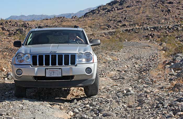
DesertUSA staff members recently embarked on a 4WD expedition into the Pinto Basin byways of Old Dale Road and Gold Crown Road. Old Dale Road starts in Joshua Tree National Park, passes through the Pinto Basin and out of the park into the Pinto Mountains, where it becomes Gold Crown Road. The route ends at California Route 62, 15 miles east of the small desert town of Twentynine Palms. I was part of the expedition and drove my 4X4. It was my first time off-road with it, and I was very pleased with its performance.

Looking back over the road to Pinto Basin
Old Dale Road can be accessed from Pinto Basin Road, 6.9 miles north of the Cottonwood Visitor Center, at the same point where the Black Eagle Mine Road begins. All of these roads are marked on the park map, which is distributed free at all visitor stations.
Requirements: 4WD required, also an excellent mountain bike trail
Time by Car: 1.5 to 2 hours
Distance: 23 Miles (one way) Not recommended for summer trips.
Upon our arrival at the entrance to Old Dale Road, we stopped to coordinate our trip and check our cameras. When I exited the jeep, I noticed a large pencil cholla stand (Opuntia ramoissima) nearby and captured some nice shots. This treacherous looking plant with numerous long, sharp spines, is also called diamond cholla or pencil cactus.

Once organized, we were ready to begin our adventure down the washboard dirt road into the Pinto Basin. On both sides of the road, plant life was abundant. I spotted creosote (Larrea tridentata), pencil cholla, numerous smoke trees (Dalea spinosa) and an occasional beavertail cactus (Opuntia basilaris). I was surprised to see so many plants in bloom in November. In the desert, no matter what month you visit, there is always something in bloom, but the yellow, white and green colors that filled the roadside were more than I had expected.
As we traveled further into the Pinto Basin, the dirt road turned from a washboard graded surface, to sand. Sections of the road passed through sandy washes bordered by smoke trees and desert willows (Chilopsis linearis); the latter were in full bloom.
On the right side of the road, as we passed through Pinto Wash, we came upon a landmark sign for Mission Well. The well was drilled in 1934 to provide water to the mines and mills in the nearby area. The foundation and other ruins from the well still remain in fairly good condition.

Not far from Mission Well, we came upon another abandoned mining area which had rusty old containers that may have been used as cyanide vats to separate the gold from the ore. Crumbled foundations and interesting rocks scattered the area. Many of the rocks contained green veins which we were unable to identify.

After Mission Well, we began our ascent into the Pinto Mountains where the Colorado Desert transitions into the Mojave Desert. At this point, we were leaving the park and entering BLM land. The road here was treacherous in areas and the slope steep. Rock-filled ravines below the road held old rusted cars and mattress springs, remnants of the Old Dale Mining District.
While climbing the rugged grade, we drove past another old building which was in pretty good condition. Whoever occupied this particular building, perched high up above the valley, must have enjoyed the breathtaking view of the Pinto Basin below.

Road to Virginia Dale Mine
From here the road leveled out and we encountered another mining ruin where we found an old dump full of rusty cans and old car parts. Only the foundation and part of a wall remained, but many other interesting items lay scattered about the area. The vegetation here seemed more characteristic of the Mojave Desert, and we encountered ratany (Krameria parvifolia), indigo bush (Marina parryi) and Mojave yucca (Yucca schidigera), all in full bloom.

View from Virginia Dale Mine
The sun was starting to descend and the town of Twentynine Palms could be seen in the distance. The road was once again a hard washboard surface with some sandy stretches.
We were nearing the end of our 23-mile journey, so we made one last stop to take some photos. We discovered a Mojave yucca with a beautiful white flower blooming from its crest. It was the perfect ending to our off-road expedition.
See this story in a
Video: Old Dale Road/Gold Crown Road
Joshua Tree NP Introductory Package
This package includes all of the information you need to help plan your trip to Joshua Tree National Park, from maps, roads and trails to geology, wildlife and points of interest.

Exploring Black Eagle Mine Road
Related Books & Gifts - Trading Post
4-Wheel Trail Driving Tips
Joshua Tree National Park
Twentynine Palms, California
Desert Plants & Wildflowers Index
Outdoor Recreation: Desert Auto & 4WD Touring


Share this page on Facebook:
The Desert Environment
The North American Deserts
Desert Geological Terms


