Great Basin National Park
Description
Overview | Climate
/Map | Things
To Do | Camping
/Lodging | Nearby
Natural & Cultural History
Natural & Cultural History
Geology
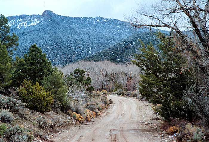
Centered on Nevada but extending into neighboring states, the Great Basin Desert stretches from California's Sierra Nevada Range on the west to the Rockies of Utah on the east. The region is one of high, silent valleys, numerous mountain ranges and many rivers. Great Basin National Park protects the South Snake Range near the Utah border east of Ely, Nevada.
The Snake Range provides a good example of biogeography, the relationship between living things and the landscape. As elevation increases, the climate changes, creating habitats for different plants and animals. During the most recent Ice Age, glaciers sprawled across the high peaks. The air was cooler, allowing forests of bristlecone and limber pine to grow on the valley bottom, along the shores of long sinuous lakes. The largest body of water was Lake Bonneville, of which the Great Salt Lake is today a shrunken remnant. About 15,000 years ago, its waves lapped against a beach just 10 miles from the current park boundary.
That changed around 10,000 years ago, when the climate turned warmer. Glaciers melted, lakes dried up, and the desert plants we see today invaded the desiccated valleys. The Snake Range became an island surrounded by desert, a refuge for temperate-climate dwellers. For many organisms with no means of transport, the desert basins presented impassable barriers. These species were isolated from others of their kind, left alone to develop unique adaptations as surely as though they were on islands in an ocean.
Close beneath the summit of Wheeler Peak, a bit of the Ice Age exists in the form of a small glacier, the only one of its kind in the Great Basin. A mere token, it calls to mind the powerful glaciers that capped the Snake Range only a few thousand years ago. Evidence of glacial activity is easy to find in moraines -- piles of glacial debris composed of boulders, sand and gravel forming mounds and ridges. Sparkling Teresa and Stella Lakes occupy hollows gouged out by ice (cirques).
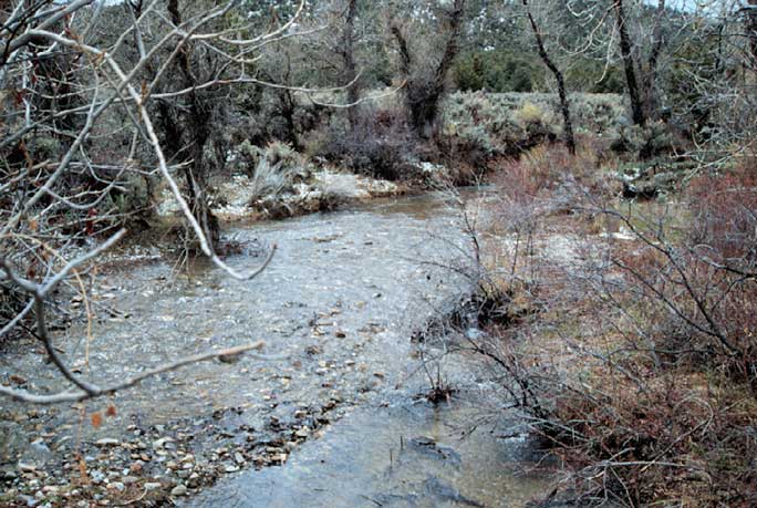
These were alpine glaciers, not the huge continental ice sheets that enveloped the northern part of the continent. Here, ice never reached the valley floor. Instead, it melted at an elevation of about 8,000 feet. You can see this in the shape of the Baker Creek drainage. Above the melting point, glaciers plucked and carried bedrock, widening and smoothing the mountain slopes. Below the melting point, cascading streams cut sharp-sided canyons.
Native Cultures
Prehistoric peoples, known from archaeological evidence, lived in this area along the shores of ancient Lake Bonneville. Later, American Indian residents lived in small villages near the present towns of Baker and Garrison from about 1100 to 1300. Known as members of the Fremont Culture, they irrigated corn, beans, and squash in the valley and hunted in the mountains. Numerous rock art sites in the park remind us of their presence.
Shoshone and Paiute peoples lived in the area from about 1300 until recently in small kin groups near springs and other water sources. They gathered and hunted a variety of wild foods, but their mainstay, especially in winter, was the pinyon nut. Descendants of these peoples still live in the area and share this harvest with other residents: pinyon jays, rock squirrels, wood rats, and other small animals.
Plants & Animals
In the South Snake Range, 13 peaks rise above 11,000 feet. On those lofty, exposed summits, winter is never far off. Snow can fall during any month, even in July. At night, freezing temperatures are common. To survive, plants must cope with a short growing season, poor soil, thin air and intense solar radiation. High winds also buffet the peaks, punishing anything that rises above the horizon -- including transient visitors such as hikers. Whatever lives here must keep a low profile. Lichen cling to rocks like paint. Dwarfed plants grow tight to the ground, firmly anchored in crevices. Shrubs appear to be pruned by a bonsai gardener. Trees live in cavities or hollows.

Bristlecone Pine
The trees found highest in the Snake Range, limber and bristlecone pines, appear between 9,500 and 11,000 feet. While both species are obviously hardy plants, bristlecone pines are the stuff of legend. True masters of longevity, they endure not centuries but millennia. On rocky slopes beyond the end of the Wheeler Peak Scenic Drive, you can walk among trees that have kept their grip on life for two to three thousand years -- some much longer than that. A bristlecone pine found here was determined to be the world's oldest living thing: 4,950 years of age.
Park History
- Lehman Caves National Monument proclaimed January 24, 1922
- Transferred from the Forest Service, August 10, 1933
- Incorporated into Great Basin National Park October 27, 1986
Great Basin National Park Baker, NV 89311-9702
775/234-7331
Overview | Climate
/Map | Description | Things
To Do | Camping
/Lodging | Nearby
Related DesertUSA Pages
- How to Turn Your Smartphone into a Survival Tool
- 26 Tips for Surviving in the Desert
- Death by GPS
- 7 Smartphone Apps to Improve Your Camping Experience
- Maps Parks and More
- Desert Survival Skills
- How to Keep Ice Cold in the Desert
- Desert Rocks, Minerals & Geology Index
- Preparing an Emergency Survival Kit
Share this page on Facebook:
The Desert Environment
The North American Deserts
Desert Geological Terms


